

MAPLand Act Passage Thru Congress Hailed; Now On To President
THE FOLLOWING ARE PRESS RELEASES FROM THE THEODORE ROOSEVELT CONSERVATION PARTNERSHIP AND BACKCOUNTRY HUNTERS AND ANGLERS
The Senate has passed the Modernizing Access to our Public Land Act, which would enhance recreational opportunities on public land by investing in modern mapping systems that allow outdoor enthusiasts to access the information they need using handheld GPS technology commonly found in smartphones.
The MAPLand Act has been a top priority for sportsmen and sportswomen across the country. It is sponsored by Senator Jim Risch (R-Idaho) and co-sponsored by Senators Angus King (I-Maine), Joe Manchin (D-W.Va.), John Barrasso (R-Wyo.), Susan Collins (R-Maine), Ron Wyden (D-Oreg.), Mike Crapo (R-Idaho), Jon Tester (D-Mont.), Ted Cruz (R-Tex.), Tammy Baldwin (D-Wis.), Steve Daines (R-Mont.), Martin Heinrich (D-N.Mex.), Cynthia Lummis (R-Wyo.), Margaret Wood Hassan (D-N.H.), Jacky Rosen (D-Nev.), Mark Kelly (D-Ariz.), and John Hickenlooper (D-Colo.).
The Senate Energy and Natural Resources Committee passed the MAPLand Act on November 18, 2021, with unanimous support. A companion bill (H.R. 3113) cleared the House earlier this month in an overwhelmingly bipartisan vote. That version, following last night’s passage in the Senate, now only awaits a signature from President Biden before becoming law.
“Hunters and anglers as well as our partners in the outdoor industry have been vocal champions of the MAPLand Act since it was first introduced, because we know that this common-sense investment will empower more people to get outside and discover new recreational opportunities,” said Whit Fosburgh, president and CEO of the Theodore Roosevelt Conservation Partnership. “Last night’s vote is a huge win in ensuring that our public lands system is accessible to all Americans, and we are grateful to both Democratic and Republican leadership for their support of this legislation.”
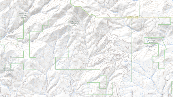
The MAPLand Act will direct federal land management agencies to consolidate, digitize, and make publicly available recreational access information as geospatial files. Such records include information about:
- Legal easements and rights-of-way across private land
- Year-round or seasonal closures on roads and trails
- Road-specific restrictions by vehicle-type
- Boundaries of areas where special rules or prohibitions apply to hunting and shooting
“We appreciate the leadership shown by members of the Senate in seeing the MAPLand Act through to the finish line,” continued Fosburgh. “Hunters and anglers across the country have good reason to celebrate this moment, which again demonstrates that conservation and our uniquely American public lands system transcend partisanship.”
xxxxxxxxxxxxxxxxxxxxxxxxxxxxxxxxxxxxxxx
The Modernizing Access to Our Public Land Act, or MAPLand Act, which would modernize and digitize map records for the benefit of public lands hunters, advanced through the U.S. Senate late yesterday under a procedural vote that allowed the unanimously supported bipartisan bill to move without objection.
Led by Sens. Jim Risch (R-ID) and Angus King (I-ME), the Senate vote follows the MAPLand Act’s near unanimous passage through the House of Representatives in March. Strong support by sportsmen’s and women’s groups, including Backcountry Hunters & Anglers, helped propel the bill to the president’s desk to be signed into law.
“Inadequate or faulty data can spell disaster for the public land hunter,” said BHA President and CEO Land Tawney, “and the importance of reliable, comprehensive information on access opportunities on our public lands cannot be overstated. Backcountry Hunters & Anglers thanks our Senate and House leaders who championed this foresighted, commonsense effort to address the problem of limited public access.”
The MAPLand Act would fund public land management agencies, including the Bureau of Land Management, U.S. Fish and Wildlife Service, Forest Service, National Park Service, Bureau of Reclamation and Army Corps of Engineers, to standardize, compile and release digital map records to the public. The publicly available information would include the open or closed status of roads and trails on public lands, vehicle-use regulations and boundary details.
Currently, more than 16.4 million acres of U.S. public lands are landlocked – surrounded by private lands – and inaccessible. Information made available through the MAPLand Act would allow hunters and anglers to discover new opportunities on public lands and waters and boost the nation’s annual $842.2 billion outdoor recreation economy.
Tawney concluded: “In a political climate that can be characterized by partisan rancor and discord, passage of a fundamentally bipartisan effort is worth celebrating. Here’s to unity and shared values in the name of access to our public lands, and here’s to the MAPLand Act becoming law!”